| Authors: | Alejandro Valdecantos and Ramón Vallejo (CEAM) with input from study sites |
| Editor: | Jane Brandt |
| Source document: | Valdecantos & Vallejo. (2015) Report on structural and functional changes associated to regime shifts in Mediterranean dryland ecosystems. CASCADE Project Deliverable 5.1. |
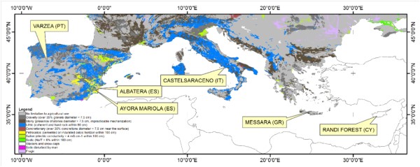
There is a clear climatic gradient across the study sites. Two of the sites fall within the humid climate, three belong to the dry sub-humid climate, and one is classified as semiarid. The average annual rainfall ranges from 267 mm yr-¹ in Albatera to 1289 mm yr-¹ in Castelsaraceno. There are also large differences in temperatures along the field sites. Castelsaraceno is again the coldest station with average annual mean temperature below 10ºC, while the hottest field site is Randi forest in Cyprus with mean annual temperatures close to 20ºC. The two Spanish sites show the lowest aridity indices (0.16 and 0.26 in Albatera and Ayora, respectively) while Castelsaraceno and, in a lesser extent, Várzea showed the highest aridity indices (1.05 and 0.84, respectively). Therefore, in addition to types and levels of degradation pressures, the CASCADE project includes a great variety of climates, soils, land uses and histories (Table 2) that may eventually condition the loss of ecosystem services.
Table: Climatic characteristics of the six CASCADE field sites
| Várzea | Albatera | Ayora | Castelsaraceno | Messara | Randi | |
| Climate | Humid | Semi-arid | Dry sub-humid | Humid | Dry sub-humid | Dry sub-humid |
| Average annual rainfall (mm) | 1170 | 267 | 385 | 1289 | 503 | 489 |
| Average mean temperature (ºC) | 13.0 | 18.0 | 14.6 | 9.1 | 17.9 | 19.5 |
| Aridity Index (mm/mm) | 0.84 | 0.16 | 0.26 | 1.05 | 0.31 | 0.29 |
| PET (monthly) | 118.6 | 136.0 | 123.4 | 102.5 | 136.0 | 141.5 |
Table: Summary of main properties of the six CASCADE field sites
| Varzea | Albatera | Ayora | Castelsaraceno | Messara | Randi | |
| Elevation | 450-600 m | 225-310 m | 830-1030 m | 972-1284 m | 100-230 m | 90-230 m |
| Bedrock | Schists | Dolomites, conglomerates and sandstones | Marl and limestone colluvium, limestones | Limestones and dolomites | Limestones and marls | Marls |
| Soils | Cambisols | Calcisols, Cambisols and Fluvisols | Regosols, Cambisols and Leptosols | Regosols | Cambisols and Luvisols | Calcaric regosols |
| Land use | Forests and shrublands (and agriculture in lesser extent) | Agriculture (52%) and shrublands (24%) | Forests and shrublands | Cropland, pasturelands and forests | Croplands and shrublands | Croplands and shrublands |
| History | Recurrent fires (1978, 1985, 2005, 2012) | Abandonment of rainfed croplands, alpha grass harvesting and wood gathering, afforestations | Fire (1979) and abandonment of wood harvesting | Land abandonment (especially after 1990s) | Overgrazing and overexploitation of water resources | Agriculture and grazing |
Fire-Driven Landscapes
Two contrasting situations are assessed on a very similar ecosystem (Pinus pinaster forest): changes of ecosystem services at the very short term on a repeatedly burned site (Várzea) and at the long term on a community without significant recovery of the overstory layer (Ayora).
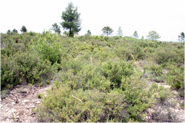
Várzea
In the Várzea study site, focus is on comparing the land degradation impacts of a recent wildfire (which occurred in early September 2012) for plots that had experienced three previous wildfires since 1975 and plots that had been long unburned (for at least 37 years) (Annex 1). During the last two decades, the predominant land-cover types have been forests, shrublands and, to a lesser extent, heterogeneous agricultural areas. These agricultural areas revealed little to no changes between 1990 and 2006, whereas this same period exhibited noticeable transitions between forest and shrubland. These transitions corresponded to a change from shrublands to forests between 1990 and 2000, and to a change from forest to shrublands between 2000 and 2006. Wildfires, in 1985 and again in 2005 (with burnt areas of roughly 10 and 1 km², respectively) are probably the reason behind these transitions.
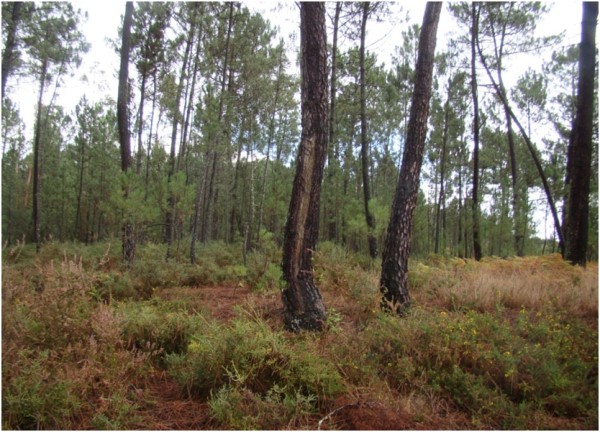
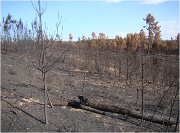
The experimental setup in Várzea was highly conditioned by land availability of the four times burned sites. Three spatially replicated plots of ca. 1000 m² were established in the Reference ecosystem (mature Pinus pinaster forest, > 40 years old) while one single block with three smaller plots was identified in the 4-times burned area (last fire in 2012). As a consequence, the length of transects and the number of subplots to assess plant biomass and litter were reduced (33 m transects and 3 subplots per plot). Biomass data of the overstory layer in the Reference plots are not yet available. As this is a key variable in determining the C sequestration service, we used available published information for a proxy of this ecosystem service in Várzea.
- Fire produced a temporal reduction of total plant cover but higher understory plant cover only 2-years after fire
- Fire opened the space for the recovery of pre-existing (both resprouters and obligate seeders) species but changed sp composition and abundance
- Recurrent fires reduced habitat heterogeneity
- Recurrent fires eradicated sensitive species to short fire interval (e.g. Pinus pinaster)
- Ecosystem functioning, e.g. stability, infiltration and especially nutrient cycling, was severely reduced by fire
- Degradation produced by recurrent fires produced significant losses for all ecosystem services considered
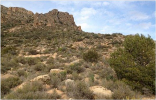
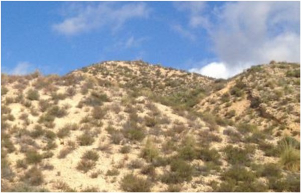
Ayora
Wildfires represent the degradation driver in the Ayora field site with strong effects on the landscape configuration. In the period 1975-2000 several wildfires took place in the area. Of these, the 1979 wildfire was the biggest and most devastating one. As a consequence, within the study site we may find different fire recurrences in such a small period of time. These forest fires have altered the composition of the forest surface, which previous to 1979 was dominated by Pinus halepensis and P. pinaster with scattered Quercus ilex individuals or small patches. Therefore, the landscape is a mosaic of pine forests and shrublands that differ in their composition and structure. The little economic activity taking place in the area is mostly associated with sheep and goat grazing. Before the 1979 wildfire, animals grazed the rangeland. As forest gave way to dense shrublands after the fire, sheep were mostly confined to croplands that were easier to go across. In limited cases, administrative subsidies promoted grazing in fuelbreaks in order to assist in their maintenance. On the other hand, goats are able to feed in shrublands but the number of animals is much lower than that of sheep (ca 3,000 vs 12,000). Furthermore, beekeeping is an important economic activity in the region. The big 1979 wildfire also resulted in a reduction of the logging exploitation of the forest from 24,000 to 2,000 m³ of wood per year. Rural tourism is an emergent activity in the area. Land tenure status has changed significantly, especially after the 1979 fire.
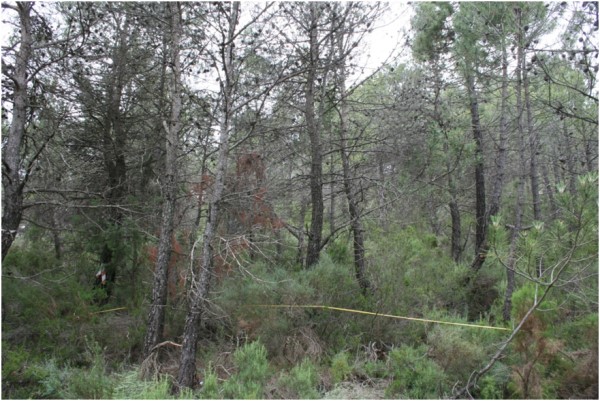
Three spatially replicated plots were established under the two states of the ecosystem: more than 50 year old Pinus pinaster forest and a secondary successional shrubland recovered after the 1979 wildfire. These two situations represent large parts of the territory of inland areas in the region of Valencia.
- Thirty-four years after the fire plant cover in the burned sites is still lower than in the pine forest
- Grasses and resprouter shrubs characterize the mature shrubland while trees are the key species in the Reference
- Secondary shrubland accumulates large proportion of dead fraction in its biomass conferring a very high fire risk to the ecosystem
- Patches of vegetation at the ground level are more abundant and larger in the burned sites than in the forest with lower habitat heterogeneity and diversity
- Ecosystem functioning was very similar in both ecosystem states
- Biodiversity and C sequestration, and their contributing variables, are the services that present the highest losses
Grazing-driven Landscapes
Grazing is the major degradation pressure in three out of six CASCADE field sites. From those, Messara and Randi share many landscape characteristics, physical features and land use histories while Castelsaraceno shows clear specificities. The three sites represent a good example of the most important environmental and socio-economic features of their respective regions.
Castelsaraceno
The vegetation cover in Castelsaraceno shows that broad-leaved forest is the most representative unit and only a small part of the surface is devoted to agriculture. After 2000, and due to rural exodus, a large part of the territory is, instead of traditional agricultural practices, covered by natural grassland and broad-leaved forest. Land cover under transition is noteworthy and there has been a progressive encroachment of pastures towards woods and shrublands. The target Reference ecosystem is a pastureland characterized by low presence and reduced quality of dominant species together with the disappearance of shrubs because livestock farming is widespread. Since 1991, the land was unevenly grazed resulting in over- and undergrazed zones.
The experimental setup in Castelsaraceno included three spatially replicated blocks, Monte Alpi, Favino and Piano del Campi. We have identified Reference, Overgrazed and Undergrazed ecosystems in all of them and three replicated plots were established for each block x pressure combination (9 plots).
- In general, Undergrazed areas show more dissimilarities to both Reference and Overgrazed sites associated to changes in plant composition and biomass
- Different directions of the grazing pressure (under- and over-grazing) changed in opposite ways the spatial distribution and size of vegetation and interpatches
- Ecosystem functioning was very similar in all three ecosystem states
- C sequestration, biodiversity and nutrient cycling are the ecosystems services that showed higher losses due to Overgrazing
- Undergrazed resulted in gains of C sequestration and biodiversity (shrub encroachment) and in losses in the soil conservation service
Messara
The natural landscape in Messara is dominated by the evergreen maquis/phrygana. Many marginal areas under natural vegetation were cleared and planted with olives. Widespread olive production in steep hilly areas in combination with grazing has triggered desertification processes. In addition further land abandonment led to less productive lands susceptible to degradation and at the same time grazing pressure significantly increased (more than 200% increases in sheeps and goats between 1980 and 1990).
In addition to the Reference and Degraded ecosystems, we selected an intermediate state of pressure defined as Semi-Degraded. Three replicated plots were established in all three states but one of the Semi-Degraded plots was completely affected by a fire in summer 2013 therefore we conducted the evaluation of this pressure level in two plots.
- Grazing pressure changed species composition and cover but Reference and Degraded sites showed more common species than with the Semi-Degraded
- Intermediate grazing pressure produced higher ground biomass while high pressure increased plant biomass mostly associated to annuals
- The most important losses related to grazing were observed in Biodiversity with lower values as pressure increased
- Soil and water conservation and nutrient cycling were also severely impacted by high grazing pressure
Randi
The study sites are open areas with shrubs and sparse carob and olive trees. The land is not suitable for agriculture anymore and it is used for grazing, in particular goats and sheep. The major land use change occurred in the 1930s, when Randi was still a forest. Currently, the natural landscape is dominated by scrublands, the typical Mediterranean maquis, garrigue and phrygana. This landscape has been formed by man-made activities such as forest destruction with subsequent periodic burning and overgrazing, followed by soil erosion.
- Plant cover and composition was significantly affected by grazing with shrubs and grasses characterizing the Reference and Degraded sites, respectively
- Grazing generated smaller patches of vegetation and more open sites
- Ecosystem functioning is severely decreased by grazing, producing losses in all ecosystem services assessed
- All variables but grass biomass are reduced in the Grazed areas, interpatch related properties being the most sensitive to pressure
- Degradation threshold might be highly exceeded
Multifactor Driven Landscapes
Albatera
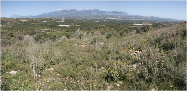
The natural climate-driven vegetation communities in Albatera site are thermo-Mediterranean shrublands, dominated by deep-rooting tall shrub species that are particularly adapted to water scarcity and extreme summer drought conditions. Intense land exploitation has led to changes in vegetation towards ecosystems dominated by subshrubs and tussock grass species. Before the 1950s, the mountain range area supported some marginal activities such as alpha-grass harvesting for fiber production and wood gathering for firewood while grazing was moderately important. In Albatera, agriculture abandonment during the second half of the 20th century mostly affected rainfed crops and agricultural terraces located on (or near to) the mountain range. Most activities also ceased on the mountain range.
- Significant plant species substitution and dominance was observed between the Degraded and References decreasing plant cover and diversity indices
- Higher connectivity between source areas is found in the Degraded and, hence, higher risk to loss of resources
- Infiltration and nutrient cycling were sharply altered by stress but stability was not
- Sink-source pattern distribution is the most sensitive ecosystem property to degradation
- All ecosystem services showed significant losses to the long-term multifactorial degradation pressures